Overview:

Manzano Peak from US 60 at dawn
The Manzano Mountains (manzano is Spanish for “apple tree”) form a range on the eastern side of the vast Albuquerque Basin. Manzano Peak is the highest point in this range. This route report describes an ascent from Pine Shadow Campground on trail T170A. Labeled as “Pine Shadow Trail” on USGS maps, but as “the Grand Enchantment Trail” on Google maps, the trail reaches towards the summit. After summitting you can follow the ridge north on Manzano Creek Trail (T170), descend to the east on Kayser Mill Trail (T80), traverse south on the Cottonwood Trail (T79) and return to the trailhead with a brief walk along Forest Road 422.

Scorched fork in an aligator juniper
Fire has given this route a split personality. The ascent on the “Grand Enchantment Trail” really is enchanting and fire damage takes but a nibble out of the enchantment. The descent on the Kayser Mill and Cottonwood trails is more sobering. The path drops through bleak and dark roasted terrain. On the shallow slopes near the base there is so much burned debris that picking out the tread is nearly impossible. It would be easy to get lost. Movement across the debris is physically demanding and slow. Researchers studying forest recovery processes may want to use this return route. Nearly everyone else will want to return to the trailhead on the Pine Shadow Trail.
Driving Directions:
- From University Avenue in Las Cruces, enter I-25 going north
- After 173.1 miles, take exit 175 for US-60 E.
- At the end of the ramp stay right and merge onto US-60E
- After 25.3 miles, turn left (north) onto Forest Road 422
- After 9.9 miles, go left into the Pine Shadows Campground (signed)
Forest Road 422 is a gravel road and currently in very good shape.
Trailhead:

The mighty Camry in the Pine Shadows Campground, with false summit above.
The trailhead is a large parking area off of FR 422. A sign for the turnoff is posted on FR 422. There are picnic tables and fire grates. A pit toilet is nearby, across the forest road from the campground entrance. There you will also find bear-proof trash receptacles. (The top of the receptacles are latched. You have to push your fingers in under the handle to trip the latch mechanism).
..
..
Data:
Light blue traces the Pine Shadow Trail/Grand Enchantment Trail (T170A). Dark red traces the summit trail. Black traces Manzano Creek Trail (T170). Dark blue traces Kayser Mill Trail (T80). Yellow tries to capture as much as possible of the path taken in lieu of the Cottonwood Trail (T79). Light red shows the return on FR 422.
- Starting Elevation: 7200 feet
- High Elevation: 10,098 feet
- Net Gain: 2898 feet
- Distance: 12.4 miles
- Maps: USGS Manzano Peak quadrangle
Hike Description:

View of Manzano Peak from FR 422
Follow T170A as it leaves the trailhead, seeming to aim for the craggy and cliff-faced canyon that lies above. Your shot at canyoneering is lost at 200 yards, where the trail crosses the canyon bed and ascends briskly towards the canyon rim. From there the trail begins a broad swing across the fall line of a rib descending from the main ridge. Looking south you can see highlands that make up the end of the Manzano Mountains. It is plateau-like terrain with the southern-most end dipping to the floor of the Albuquerque Basin.

False summit above the forested rib.
Threading small stands of juniper and pinyon, the trail suddenly stops switchbacking and sidehills to the northwest, then to the west, and finally north to gain a shoulder on the rib. Views open to a false summit, its face strewn with numerous downed trees – evidence of past fires. The rocks underfoot include snowy chunks of what may be marble. (Some metamorphic rock is said to exist in the Sandia-Manzano mountains). It is markedly different from the rocks found along the trails of the southern mountains.

Broad chute, with numerous snags, south of the false summit.
The trail laterals across an open basin and appears destined to enter a vividly green hanging valley to the south. Before you can get there the trail swings around a rib, reverses back to the north and enters a broad chute populated with scorched poles. A substantial forest of tall ponderosa has been lost to flames. Some secondary growth has taken place. In places the floor is dense with brush, often thorny. The trail does an excellent job of rising into this declivity while staying above the brush. Eventually it darts across the bottom of this steep vale to the far side and starts to descend. It is here that the trail first becomes sketchy. Burned trees have an eerie tendency to fall lengthwise along the trail. The blackened branches slow progress and obscure the tread. Perhaps the blockage makes it impractical to bring horses past this point, which would contribute to the tread’s decline.
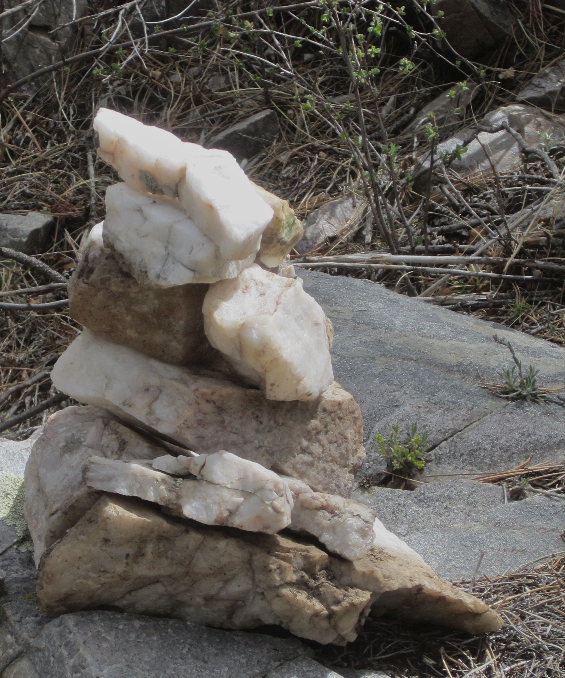
Marble cairn along the side of ridge line trail
After about 100 yards of descent the trail finds a notch and climbs up onto a shelf that protected its plant life from the fire. Breathe a sigh of relief to have that destruction behind you and begin a long ridge ramble towards Manzano Peak. Douglas fir becomes increasingly common as the alligator juniper and pinion pine begin to fade away. Those snowy white rocks become increasing common as the trail contours wide to the west, strikes a rib top and snaps back east to approach a false summit. It is easy to scramble to that false summit in the hope that you are arriving at the true summit. Uneasy, though, when you look a mile to the north to where the true summit floats high above you.

View of true summit from a small col just north of the false summit
That mile is easily traversed on a fading tread that was emplaced by an inspired trail team. it climbs gently, takes every opportunity to change ridge-side so that you get glimpses north and west into the Albuquerque Basin and then views south and east into the Estancia Basin. The ridge is too densely forested for broad views, but the glimpses can be spectacular. The footing is excellent even where the tread disappears. In no time at all you enter a large meadow on the southwest side of Manzano Peak. The trail does not go directly to the peak. Instead, it contours below the peak on the west side. This is the realm of large Douglas firs.Those who learned to hike in the Cascade Mountains will feel right at home. Eventually you come to the ridge on the north side of the summit. There you will find a signed side trail that leads you to the top.

Summit sign. The summit register is in a mailbox at the base of this sign.
The summit is half forested and views to the north are blocked. Other hikers have reported spectacular views to Ladron Peak in the southwest and to the Capitan Mountains in the southeast. I can’t say, since the weather was deteriorating on this visit. There was a disconcerting amount of haze to the west, suggesting that rain might be on the way. It seemed like a good time to snap one or two photos and get off of the high ridges. Most people will want to return the way that they came. Here, however, I’ll describe the northerly loop.

Open meadows in a saddle along Manzano Mountains ridge. T80 leaves to the right.
Descend the summit trail back to T170 and continue north. Long stretches of the tread are disappearing under grasses and forest duff. The trail stays near the ridge top, so if you find yourself off trail then return along the ridge to the last clear tread and scout for faint depressions in the soil. There is supposed to be a junction with the Monte Largo Trail soon after leaving the summit block. I never found it and assume that the Monte Largo Trail is even fainter than trail T170.
At about half a mile after leaving the summit trail come to a wide and grassy saddle in the ridge. At the mid-point you will find two signs that have been blown over. The carved letters are starting to weather away, making the signs difficult to read. Close inspection will prove you are at the junction of T170 running north-to-south and the Kayser Mill Trail (T80), descending to the east. The large meadow is overgrown and innocent of tread in any direction. Look downhill to the east and you will discover several cairns near the edge of the meadow. Those mark your way.

Burn debris piled five feet high across the trail.
After leaving the meadow the trail becomes much easier to pick out. It descends at the mellowest possible rate, forming a long traverse beneath a side-peak east of the main ridge line. In many places the trail shows sign of recent and careful maintenance. In other places the tread is pressed by avid vegetative growth. There is a one species of dark, smooth-barked thorn bush that you quickly learn to watch for. After a long tour to the east the trail makes a sharp turn back to the west and begins losing altitude in a wide drainage. This part of the hike is still in heavy vegetation. It crosses a boulder field where a trail crew once did heroic work in smoothing the way, perhaps to make the trail easier for horses. Rise out of this drainage, (now heading a little east of south) and enter a burn zone.

View from Kayser Mill Trail down burned slopes.
At first it isn’t bad. In its highest reaches the fire touched only narrow swaths of trees. The descent to the southeast is a long one, however, marching all the way to a point directly east of Manzano Peak. As the tread gets lower the damaged swaths get wider and the groves of unburned trees get narrower. Fallen trees lie in tangled piles, forcing the hiker to use a high-stepping stride. In many places the trail is completely blocked and there is no choice but to divert around. Charcoal seems to cover everything. There are a few green plants coming back, but their numbers are small. It may be that the fire was hot enough to kill seeds unless they were buried very deeply. Thorn bushes seem to have fared best, and they are not kind to backpacks, cotton shirts or exposed skin. It was great to see a fat turkey up here, clearly some creatures find these burns to be very agreeable. Eventually you reach a deep gully that comes down from the Manzano summit. This fold in the terrain seems to have fended off the fire. The path winds past living trees as it descends this waterway.

View through snags on the alluvial fan at the base of Manzano Peak.
The trail enters a huge alluvial fan at the base of the mountain. On these gentle slopes the fire was particularly devastating. Hundreds of snags have fallen for every standing pole . Where once there was dense forest you can sometimes see for half a mile or more. But you can’t see the ground. Burned bark, burned roots and innumerable burned limbs and trunks are heaped everywhere. It proved impossible to stay on the trail. As an alternative, head downhill. The maps show that Forest Road 422 fronts this part of the range.
Before striking the road, however, you might come to a clear trail heading south. It can be startling to see such order amidst this ruin. Perhaps it was merely a fluke of the forest fire. In no more than a quarter-mile the tread disappears beneath the remains of burned woodland. The tread does, however, bring you to within a half mile of the burn’s edge. It is a half mile of very slow hiking, zigzagging constantly to avoid the worst debris piles. Even then, it is often hard to find a place big enough to accommodate your foot in the direction you want to go. Your return to the unburned woods will be a huge advantage. There, find a deep gully and follow it in easy hiking conditions. It will return you to Forest Road 422. Go right and follow the road downhill to return to Pine Shadows Campground.
Recommendations:

Author approaching Manzano summit (Albuquerque basin and distant storm in background).
The burns that complicate this route will heal. The surrounding forests and high terrain might even become safer for it. For the moment, however, the stark descent on T80 and the uncertain traverse on T79 can not be recommended for most parties. Hikers will generally want to hike the Pine Shadow Trail up to the summit and return by the same route.

Not-so-mighty Camry, undergoing tire repairs along side US 60. It can be tricky pulling off the road for photos!
In the summit register there are messages from people who have recently climbed to Manzano Peak from the Ox Canyon trailhead. It might be worthwhile to drive further north on FR 422 and see if the terrain surrounding Ox Canyon is unburned. If it is, you could set up a car-shuttle starting at Pine Shadow and ending at OK canyon. It would not be feasible as a loop unless you enjoy long road hikes.

Evening view of the Manzano Mountains from US 60. It looked stormy up there.
Those who are interested in seeing the damage in this part of the range will want to wait for a wind-free day. (Unsurprisingly for an April day, a breeze blew continuously on this hike). The creaking of snags makes for uneasy background music. I was surprised by how chilly it was. Of course, a windy spring day spent at 10,000 feet has the potential to be cold. On breaks the first thing I reached for was my jacket.
The trailhead is only an hour from Albuquerque and I expected to see other people. There were no other cars at the trailhead in either the morning or the afternoon. There were no other hikers on the trails and no horse riders. I saw a grand total of two other vehicles on FR 422. Given the overgrown nature of the trail, you can expect to find solitude in the springtime Manzanos.
Maps are great. Out in the middle of the those trackless burns you can get your position based on the surrounding terrain. A GPS has similar virtues (I had both). It is the map, however that gives you the clearest big-picture view. Besides, your location is too important to trust to electronics. A busted screens or dying batteries can be vexatious.
Links:
If you are driving to Manzano Peak from the north then it is common to use Forest Road 253. A comment in the Summit Post indicates that this road is closed in the winter. The same may be true of winter driving on road 422 from the south, although the only gate that I can recall on 422 was beyond (north of) the Shadow Pines Campground.
The National Forest Service generally has information on road closures and fire alerts. The Manzano Mountains are part of the huge Cibola National Forest/National Grassland (patches of which extend across Oklahoma, Texas and New Mexico). The Manzano range is part of the Mountain Air ranger district – phone numbers are provided. I checked after returning from the hike and did not find any comment on the status of T80 or T79, which is a little surprising.
The Grand Enchantment Trail (GET) is a route joining many smaller trails into a network that extends from Phoenix, AZ to Albuquerque. See a summary of the different segments at Simblissity. In a similar vein, the trail T170 does more than just take you to Manzano summit. According to Trails.Com it stretches 44 miles along the Manzano Mountains.
Jean Robertson points out in a 2010 post that the trailhead has corrals and a watering tank – features that I did not notice on this trip. They may be off to a side. On the other hand, a large amount of recent effort has gone into restoring the riparian terrain immediately adjacent to the campground. It may be that the tank and corrals have been removed to encourage faster regrowth of the wetlands. Check with the rangers before bringing your animals. (There was a little horse sign along the trail, but so little that it suggested that the trail is not been much used by horsemen).
Voyageur, writing a year ago, has a brief post about Manzano Mountains. He, too, notes that in places along the upper ridge line there is a tendency for the trail to disappear.
